Residents now have a general idea of the route the regional waterline will take.
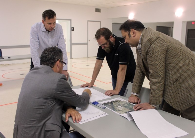
The Cold Lake Regional Utility Services Commission (CLRUSC) held an open house Wednesday, Aug. 23 to address possible concerns regarding the route.
Members of Dema Land Services, engineering company Aecom, and the Bonnyville Water Services Commission were also on hand to field questions.
Beginning at the Cold Lake Water Treatment Plant, the transmission line moves along the Alberta Iron Horse Trail. The plan is to have it pass through a transfer station near CFB Cold Lake, before deviating from the trail and heading towards Hwy. 28.
From there, the waterline will move back onto the trail, following it to the Bonnyville reservoir and pump house.
Connecting to the waterline
The question of the day was whether or not residents would be able to connect their property to the transmission line.
For the general public, such a connection will not be made available. For those with parts of the waterline on their property, exceptions can be made.
“It has mainly to do with negotiations with landowners the waterline will come across. If an owner along the trail wanted to get water from the line, whether or not they're able to is a part of the negotiations,” explained MD of Bonnyville CAO Chris Cambridge.
To avoid contaminating the waterline, a cistern must be installed between properties looking for a connection, and the line itself. A possible snag in the negotiation will be who covers the cost of connecting. As it stands, the onus falls on the property owner.
“All of the necessary connections would be at the cost of the landowner. The biggest problem is that huge cost. If a resident wanted to get water from the south side of the highway, it's a very costly process to horizontally drill across the highway,” said Cambridge.
Concern over the environment
One of the hot button issues throughout the night was the environmental effect the waterline could have.
“We've had residents concerned with tree removal on their property and how the line effects the trees next to their home or development. There are a lot of questions on whether we will be removing those trees or not,” explained Michael Moncrieff, Aecom civil engineer.
Due to the size of the pipeline, the project is likely to come with at least some environmental loss.
While potentially inconvenient to some, Cambridge said removing some of the forestry could have a positive effect on the adjacent roadways.
“It's a wide pipe, so the area needed for staging is very wide. The concern is a large loss of trees. It's great to have a road with a lot of trees around it, but the trees can actually cause the road not to dry out (after precipitation),” noted Cambridge.
Upon completion of the project, the MD of Bonnyville intends to use the cleared out space to their advantage, specifically along the Iron Horse Trail.
Currently, staff are exploring the option of creating a two-lane pathway, allowing for more activities along the trail.
“We're actually looking at a walking trail between Fort Kent and Ardmore that would split into two. We could almost make it into a divided highway where you have quads on the left and walking on the right, so that's a great opportunity,” said Cambridge.
Finding the best route for everyone
Some residents took issue with the line encroaching on their property, and had no problem voicing their concerns.
“They plan to take out 15 metres of my land, and then they're going to put a sewage line in which will take another 15 metres. I've designed my whole property and this is causing me to redesign all of it,” said Dexter Dahlseide.
According to Moncrieff, the feedback Aecom received was one of the big reasons for holding the open house in the first place.
They plan to use the information to work with landowners, in an attempt to find the best option for both sides.
“Creating discussions with landowners is very valuable to us. We have to negotiate with them to be able to build across their land and this helps us facilitate that,” said Moncrieff.
Since the route hasn't been finalized, the feedback will help engineers determine what needs to be done to get property owners on board.
While the open house provided a first look at the waterline, the route is not set in stone. When the project breaks ground, it could end up looking a little different than the current plan.
“I've seen about 10 different variations of this route, and we're down to about two. It's always better to have an idea of what we're dealing with,” explained Bonnyville CAO Mark Power.
He continued, “When a builder has to approach a property owner about using their land, the first question is always, where? Now we have pictures and we can show them the preferred route. It really helps.”
Expected timeline
No firm date has been set for breaking ground on the project, but a concrete completion date is in place.
All parties involved have agreed to meet the timeline set out by the conditions of the government grant needed to build the pipeline.
“The question I've been hearing the most is, ‘when is it coming?' I'm happy to tell people we will have this complete by March of 2019. That's the drop dead date for the grant money to be spent, so we are committed to completing the project by then,” said Power.
The route the waterline will take is expected to be finalized sometime before the end of this year, with construction kicking off sometime in 2018.
“We're in about the 70 per cent complete range. This route mapped out today is still subject to change,” said Moncrieff. “Right now, we're looking for a final design for later this year, with construction to get underway at the end of next year.”


