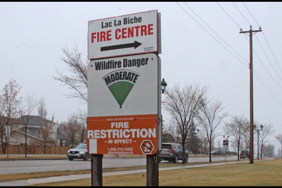
LAC LA BICHE - As rain fell in the in the Lac La Biche region earlier in the week, the wildfire hazard sign at the entrance to the Lac La Biche Fire Centre on Beaver Hill Road was lowered to "Moderate." The hazard has been displaying "Very High" rating prior to the rain and sleet that fell across the area from Sunday night into Tuesday.
The wildfire hazard signs – like the one outside the Fire Centre – range from Low to Extreme. The ratings are a common sight for residents and visitors to the Lakeland region. While the signs are changed by turning a simple wheel of hazard terms, the reasons for the changes are complex and include weather and historical data, say local wildfire officials.
According to Colby Lachance, an information coordinator for the Lac La Biche Forest Protection Area, the hazard levels are based on software used by the provincial government department called AWARE (Alberta wildfire anticipation readiness engine). The AWARE system, she explained, pulls numbers from government automated weather stations across the province to give staff in the province’s eight forest protection areas the information about what to expect for approaching fire-weather probabilities.
When making the call whether to change a level on the sign, the duty officer at the Forest Centre examines the weather information that is inputted into the AWARE system. From there, the duty officer determines what level of fire danger to the area should be at. Lachance said that the weather department at the Alberta Wildfire Coordination Centre in Edmonton has a team of skilled meteorologists who examine weather station data, weather patterns, and forecasts to input into a shared system for duty officers in the Forest Area across the province to calculate the fire danger level.
“The weather group watches the weather on their systems and inputs the information they receive from remote weather stations so that the Duty Officer can make the call at the local level for the fire danger,” she said, explaining that along with weather data, that fire danger level is a general assessment of the fire environment that determines the ease of ignition, rate of spread, difficulty of control and fire impact.
“If we experience dry conditions the fire danger level is likely to hover from high to very high and finally it can be changed to extreme,” she said. “If we experience more precipitation, it is likely to be kept at low to moderate.”
Local fires
The Lac La Biche Fire Protection Area includes an area of northeastern Alberta stretching from Kikino to Anzac and Cold Lake to Calling Lake. Going into the weekend, there were two active fires reported in the area; one a blaze of less than a hectare in the Janvier area and another, larger fire of more than 50 hectares about 10 kilometres south of the Fork Lake community.
Across the province at the same time, forestry officials were reporting 40 active wildfires. More than half of those fires are in the Slave Lake and High Prairie fire protection areas of northwestern Alberta.
Even though the Lac La Biche region has recently experienced cooler, wetter temperatures, Lachance says wildfires can start in these conditions and therefore, officials with the Lac La Biche Fire Centre are asking residents to still use caution when enjoying the outdoors. For anyone seeing the fire hazard signs and needing more information, Lachance said more details on fire restrictions, protection areas, forest fire awareness and fire bans can be found at the Alberta Wildfire website.


