BONNYVILLE – During a regular Town of Bonnyville council meeting, Bill Rogers, the CAO for the Town addressed concerns from residents that had been brought to the attention of councillors in regard to snow removal in residential areas.
“When it comes to snow clearing on sidewalks, there's a requirement that you clear within 48 hours of a major snowfall, now that that being said, we share a number of challenges with our residents this year,” said Rogers at the Jan. 25 council meeting.
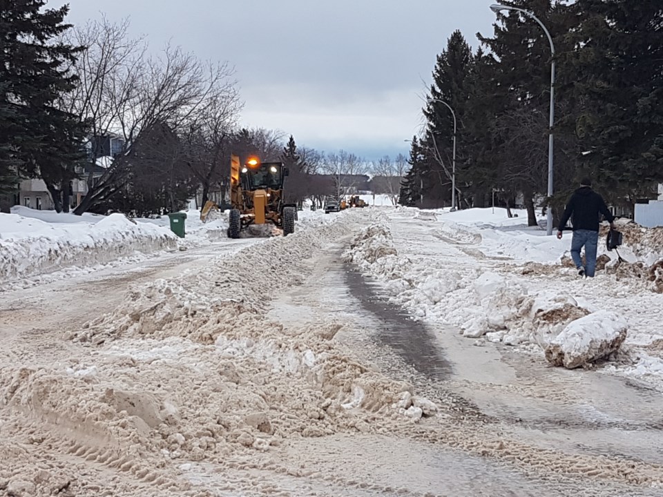
Rogers emphasized that the region has seen a high volume of snowfall accompanied by numerous freeze and thaw cycles.
“For example, it was -28C when I got up this morning and it was +2C when I went home at supper time... a freeze thaw cycle like that means you might have a hard pack street in the morning that is not causing any issues and by the time you go home at dinnertime and things are all warmed up, all of a sudden there is six inches of loose snow and you're scrambling to get around,” said Rogers.
He added, "We try to balance that especially at this time of year with two graders on the go and crews working seven days a week to try to keep on top of it.”
Another challenge that public works crews are facing is the quantity of snow. The public works crews have already filled the Town’s designated snow dump location to its capacity.
“We have just finished filling our snow dump that we normally use every winter, and it's only the end of January. I don't know that I've seen that before,” he said, adding that another location will have to be opened to relocate snow removed from public roads.
Outlining the snow removal priorities for public works employees, Rogers said, “After a snowfall the first thing we do is emergency routes, along with that we do school zones, business routes and arterial collector roads like Lakeshore Drive.”
The routes are then followed by emergency service sites, municipal specific facilities and lastly, back alleys.
Rogers added that crews are also split between residential roadways and back lane work.
“This time of year, we start splitting our time between roadways and back alleys. Now, back alleyways are normally the last thing that we do, but this time of year, especially with the freeze (and) thaw it becomes harder to get around. So, we've been splitting our time between trying to keep attention on both of those, with the goal in mind that no road in town should ever be impassable.”
Although roads may become inconvenient to travel on at times due to shifts in temperature, Rogers says "I don't think we have any that are impassable, and we certainly do our best to keep on top of that.”
He continued, “We are running crews seven days a week now with both graders and we'd ask residents to be patient as best (they) can – we'll get to you.”
For residents experiencing their own challenges clearing snow from their walkways, Coun. Kayla Blachette noted the FCSS Snow Angels program, which identifies homeowners who need a hand in clearing their sidewalks with a yard sign.
“There isn't an army of shovelers waiting to go out and clear sidewalks, but if you do know that your neighbour has barriers, perhaps do the neighbourly thing and give them a hand – that won't go unnoticed,” said Blanchette. “You never really feel bad for doing something good.”
Bonnyville and area forecast
Bonnyville and area residents can expect snow beginning late Thursday evening through Friday, with light flurries continuing during parts of the day Saturday.
Varying forecasts anticipate between 4-12 cm of snow to fall between Thursday and Saturday, with the bulk of precipitation expected Friday.
Based on Environment Canada data, this evening there will be increasing cloudiness. Snow is expected to begin after midnight. Wind reaching up to 15 km/h. Low of minus 30 with temperature rising to minus 24 by morning. Wind chill near minus 36. Risk of frostbite is noted.
On Friday, Environment Canada suggests roughly 2 to 4 cm of snow can be expected. Other weather networks suggest higher volumes of snow fall is likely.
Wind up to 15 km/h is expected for Friday with a high minus 19. Wind chill minus 36 in the morning and minus 26 in the afternoon. Risk of frostbite is high.


